
by HUSSAIN INDOREWALA
Originally published on Kafila.org
Tuesday, February 17, 2015
In the early 1970s, a conservative government in the UK set up a study group for the London Docklands. Its report, which focused primarily on exploiting the commercial potential of the docklands, was torn up and thrown out by local community groups and the local boroughs. Later, in 1974, a strategic-planning authority called the Docklands Joint Committee (DJC) was set up to plan the area. This committee included, along with central and local government representatives, the Port of London Authority and trade unions; it was also associated with the Docklands Forum, which was a group that represented various sections of the public, including “militant community groups.”[i] The DJC along with the Docklands Forum adopted a radically new approach to planning: it instituted a bottom-up process, working with communities entailing a “delicate, even tentative, negotiated style of planning.” The planner was now the “servant of the public” and the “large-scale, top-down, professionally oriented planning” was replaced with its opposite.[ii] Significantly, the DJC came up with a comprehensive plan – the London Docklands Strategic Plan of 1976 – that was based on the preservation of manufacturing, creation of social housing, and social programs for residents of the area. So progressive it seemed, that it never got realised. In 1979, Margaret Thatcher became Prime Minister of the UK, drowning any little hope that remained.
Flying over London, in the mid-70s, Thatcher’s Secretary of State for the Environment, Michael Heseltine had found “appalling proof” that the various committees, reports, discussions were hopeless, and since everyone was involved, “no one was in charge.” New legislation was written, that created powers to establish Enterprise Zones and Urban Development Corporations. The London Docklands Development Corporation (LDDC) was created in 1981 as the planning authority for 5,500 acres of the dock areas. Entrepreneurial in style, ideologically committed to private enterprise, the LDDC did little planning, and used consultants who provided guiding frameworks that were flexible and demand-led, and focused more on implementation rather than planning. Heseltine wanted the LDDC to be “seen to do things” and liberated from “the inevitable delays of the democratic process.”[iii] The LDDC as an Urban Development Corporation was run by a board appointed by the central government, giving local authorities very little power, which they refused to use anyway. The problem of too much democracy was solved by excluding residents from the planning process.
The LDDC was criticised for its neglect of the area’s original residents, the creation of predominantly service sector jobs that offered little employment to displaced dockers, and land sale for private sector housing development that made units unaffordable for residents. The criticism and crises seemed to have some effect, gradually making the LDDC open to community consultation. By the late 90s, it had spent 110 million pounds on social and community development, about half for education and training. 23,000 new jobs were created, and public transport and road networks were augmented. 6,400 new social housing units were constructed, and 8,000 existing units were improved; close to 40,000 of the original inhabitants were retained in social housing units, despite most having lost their industrial and port employment. Nevertheless, the LDDC’s core aim was to promote growth through private sector investment in Greater London, and improvement of the lives of local communities “was at best a subsidiary goal.”[iv]
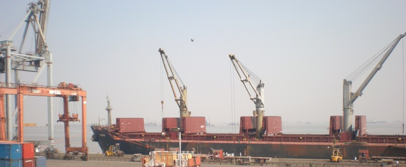
Mumbai’s docklands have now been opened for development. To some, the announcement represents “Mumbai’s biggest chance in a century to renew itself,”[v] with floating hotels, marinas, iconic monuments, open spaces, leisure zones and world-class transport facilities. For some others, it came with a 12 hour demolition notice.[vi] On January 8th, 150 homes were bulldozed by the Mumbai Port Trust (MbPT) at Powder Bunder, a settlement of more than 5000 people engaged in informal work, contract work at the Mazgaon Docks and ship breaking activities. Another 5 homes were demolished the next day. No rehabilitation plans or arrangements were made; the Union Minister for Transport, Highways and Shipping spoke about evicting “all encroachers” from port lands.[vii] As a committee set up by his department was recommending rehabilitating all “eligible slums,” the Port Trust moved quickly to reduce the number that might require rehabilitation.
The Mumbai Port Land Development Committee (MPLDC) was set up by the Union Government to sketch out a “vision for the future development of the eastern water front” taking into account the needs and concerns of the Port, the needs of the city and its overall development “with an emphasis on providing alternative modes of public transportation and promotion of tourism and recreation.” The MPLDC includes officials of the MbPT, former bureaucrats, architects and representatives of big business groups; unlike the Docklands Joint Committee in London, formal and informal labour unions and residents do not find representation in the Committee, nor does it include citizen and community groups from the rest of the city. Though the Committee acknowledged and included suggestions made by individuals and institutions in their report, the suggestions received were made without a prior understanding of the existing situation in the area – in the absence of publicly available studies, most of the suggestions were made with the assumption that the port lands are a contiguous greenfield site, waiting to be resuscitated with innovative ideas.
Port Lands: The Existing Situation
The best overview of the existing situation is provided by the MPLDC report itself. The MbPT controls 752.7 Ha of land in the city, out of which 709.5 Ha abuts the eastern shore. The MPLDC studied 721.2 Ha of the total land, and found that about 60% (421.8 Ha) of this area can possibly be made available for preparation of a land-use plan, excluding the core port activities, and the oil tank farms that are under government and private holdings. The sixty percent consists of built-up areas (146.6 Ha) that includes Ballard Estate, Apollo Reclamation, Sasoon Docks, and MbPT staff quarters and amenities requiring improvements and conservation rather than re-development. It also consists of storage areas and facilities such as the Elphistone Estate, Coal Depot and Darukhana, much of which are sub-optimally used or unused. The port trust has around 11,500 registered employees and about 34,000 retired employees. The MbPT housing estates consist of 7,700 units housing about 5,000 employees on 48.79 Ha, and approximately 28% of the estates are either vacant or underutilized. According to an “incomplete” 2002 survey undertaken by the MbPT, 14,365 informal housing units were recorded occupying about 7.46 Ha of land. The MPLDC rightly suggests a fresh survey to determine the number of households that live informally on MbPT lands. It will be fair to assume that many, if not most of these households find employment as daily wage workers at the ship breaking yards, scrap yards or warehouses, or as contract workers at the Docks. This means that despite the decline of Mumbai Port, the land is still a source of employment and residence to a large number of people in the city, who would be most directly affected by its transformation.
Planning and Authority
The MPLDC recommends handing over planning functions of the Port lands to a “Special Planning Authority” (SPA) and recommends setting up a body called the Mumbai Port Land Development Authority (MPLDA). This will be a body quite similar to the London Docklands Development Corporation. Under the Maharashtra Regional and Town Planning (MR&TP) Act, an SPA replaces an elected local authority such as the MCGM as the new development control authority, giving it powers to acquire land in a notified area for the purpose of development, formulate policies regarding land use and zoning, powers to tax and levy charges, and other powers. As a result, it wrests local control over planning decisions and hands them over to bureaucrats – free from the “inevitable delays of the democratic process.” The MPLDC’s stated reason, incidentally, is to “minimize the need to obtain various sanctions and permissions from multiple authorities.” However, SPAs are not new to Mumbai; according to the MCGM, 4322.8 Ha or 9.4% of the total land area of Greater Mumbai is under SPAs, and if the Port lands are set up under an SPA, 11% of Greater Mumbai area will be placed outside the planning jurisdiction of the MCGM.[viii]
There is another provision in the MR&TP Act[ix] that can be suitably applied to the Port lands. Section 33 of the Act gives a local Planning Authority powers to prepare detailed micro-level plans for areas requiring “Comprehensive development.” The Planning Authority has to follow the same procedures that are followed for the preparation of the Development Plan for the city, and no separate Planning Authority need be formed under this section. The MCGM has already indicated its willingness to create “areas of Comprehensive development” in its forthcoming 20 year Development Plan – for slums, inner city areas, mill lands, transit nodes and heritage precincts – and the Port lands can easily be made one of these.[x] The advantage is that the MCGM makes the plan as part of the Development Plan, which works better for overall planning, and remains the Planning Authority, which makes the process – at least in theory – more accountable.
Purpose and Ownership
If every land owner were to be the sole decision maker for the use to which her or his property is put, no city would be possible. A city is, among other things, a social institution, and begins when dwellers decide to cooperate for the fulfilment of their material and social needs. And as the urban planner Shirish Patel points out in his letter to the MPLDC,[xi] urban land is a common good: unlike shoes and cars, its commodification cannot prevent access to non-consumers; and unlike air and radio waves, private control by individuals or institutions necessarily deprives others from simultaneously enjoying it. If land is held as a common, mechanisms for collectively and democratically determining various uses of that land can be set up, and reviewed periodically, and individuals and institutions may be assigned plots for use as determined. There would be no owners, only users who would have temporary control over a parcel, and they would be free to transfer control to someone else who is willing to use it for that purpose. The advantage here is that no one can profit from land, though they can benefit themselves and others from its assigned use. Interestingly, certain elements of this arrangement exists in the old distinction between land-use planning and ownership, where owners of land are expected to use their land as prescribed by “the plan,” or they are free to sell it to someone who is willing to do so. It is based on the understanding that in a complex society, even owners have limited, not absolute rights on their property. The well-known problem with this system, however, is that “the plan” is contrived by technocrats and special interests and imposed by state power as the “common good,” while land owners profit from the value of land that arises out of its use and location.
The Port lands, since they belong to a public agency, are a public resource. It may be important for a public agency like MbPT to retain ownership of the lands, while its uses are decided by an assessment of the needs and priorities of the city, and extensive debate among people of various income and social groups, public agencies and residents and workers of the area. The Trust could lease out land or rent out space for these prescribed uses, and by not privatising this crucial common resource, it can provide for a range of public institutions, accessible social infrastructure and social housing that is close to impossible to achieve anywhere else in the city.
Priorities and Preferences
It is clear that preferences and priorities are two different things, but these are often confused. Most of the hundreds of suggestions received by the MPLDC express people’s preferences for the port lands. Once again, unless the context is provided and the situation is well understood, it is impossible for people to make reasoned suggestions. For instance, Rahul Bose reportedly prefers to see “a multi-sports facility” on that stretch,[xii] some others would like to see a Bollywood museum, some a London-eye type Ferris wheel. Most suggestions demand green open spaces, parks and gardens. But are these the city’s priorities? Who gets to decide them? Here we must consider some facts. According to the 2011 Census, 1.13 million households (42.6%) in Mumbai live in what a Government report termed “housing poverty,” living in “unacceptable physical and social conditions.”[xiii] 72% of households in the city live in single room accommodations or without any exclusive room. In terms of health, if it has to be universally provided, Mumbai is staggeringly deficient. The National Urban Health Mission prescribes one Urban Health Centre for 60,000 people. Mumbai has only 4 of these, and would need to build and run another 199 Health Centres. According to the UDPFI guidelines,[xiv] there ought to be 1 maternity hospital for every 100,000 people. There are only 28 such MCGM run maternity hospitals. We have only 16 general hospitals in the city while we require 49. Similarly, take education. The city has 1248 government run primary schools and 49 secondary schools functioning. It in fact needs 1240 more primary and 1600 more secondary schools. Significantly, the E, F/S and F/N wards, of which the port lands are a part, have some of the greatest shortfalls of primary and secondary schools in the Island City, with the exception of G/N ward. In fact, F/N ward is ranked one of the lowest in terms of Human Development Index in the city, and developing health and educational facilities within this ward is an urgent necessity.[xv] Many of these scandalous deficiencies were pointed out to the MCGM by community groups during the Development Plan consultations.[xvi]
For middle and upper income residents of the city who can afford good quality private healthcare and education, open spaces and recreational facilities seem to be the most pressing lifestyle need. Though parochial, this view is understandable. But a little bit of perspective is necessary: Mumbai is often compared to other cities like Bangalore and Delhi to show inadequacy of its open spaces and parks. It is no doubt true that Mumbai has just 1.24 sqm per capita open space, compared to 6.4 sqm in Bangalore. But this is a poor comparison – in addition to having almost three times the population density of these cities, Mumbai has a 73 Km coastline, which most other cities do not. If carefully used without “public” encroachment[xvii] on the coastal commons, these can partially make up for the shortage. The more important problem, however, is access to open spaces. There exist in the city today open spaces for exclusive use (private gardens and beaches, open spaces in residential societies), open spaces for upper and middle income groups (“pay to use” or “members only” facilities such as golf courses, specialized parks, clubs and gymkhanas) and public open spaces that can be used by all. This means that the amount of open space rapidly shrinks as you descend the income ladder. But increasingly fenced and policed, even “public” open spaces are becoming inaccessible to the urban poor; a range of socio-spatial barriers rigorously enforce discipline and control on kinds of activity, timing, and movement. In these spaces one is expected to move, like Newton’s planets, in “law-abiding” orbits. Parks are closed during office hours, as one is required to be industrious from 9 am to 5 pm. After work hours, walking your dog is respectable, vending fruit is called “encroachment.” One way to increase per capita availability of open spaces, it seems, is to reduce the number of people that might want to use them.
The MPLDC suggests utilizing 30% of MbPT land for open spaces and parks. Is this the best way to use this land? Are health and education for almost 80% of the city less urgent than the lifestyle needs of the 20%? And if public parks are built, what sort of parks will these be? In their chapter on implementation, the MPLDC report recommends creating three kinds of activity clusters, the first that are profit generating, the second that are self-sustaining ‘public’ facilities run on the basis of user charges, and activities such as public parks and museums that require capital and operational subsidies, where it “may also be useful to explore the notion of ‘privately owned public spaces’ where private owned and managed public spaces are made open to the ‘public’.” These will hardly be the kind of spaces that will benefit the entire city.
Housing and Employment
The MbPT is being imagined by the MPLDC as a branded “Global / Regional tourist destination” offering “Leisure Tourism Facilities” and “Culture Tourism Facilities” supported by hospitality and entertainment uses. In addition, an international / regional business and financial district will be supported by ancillary hotels, retail, lifestyle and entertainment uses. The Committee envisions urban regeneration through tourism for the port lands, and in line with other tourist destination cities elsewhere in the world, one can expect luxury hotels, convention centres, and high-end residential uses to be eventually strung along the coastline. The restructuring of the port lands is meant to move out formal and informal manufacturing, as its proximity to the Central Business District of an emerging “global city,” makes the area, according to an MMR mega-vision, “highly strategic for other more compatible activities.”[xviii] To make the city a tourist destination, the city as “product” is envisioned and redesigned for visitors rather than for residents;[xix] and as Catherine Boyer adds, it must therefore be reduced “to a map of tourist attractions” where a wide-eyed tourist “public” will graze the “culinary and ornamental landscapes” of leisure-time spectacles, sea-food restaurants, and site-seeing promenades.[xx] This of course would be fine if a tourism based service sector could generate large scale formal employment, provide equitable benefits and spur improvements in the built environment – but as the Planning Commission points out, in the past two decades in Mumbai, “the growth of formal sector jobs in the services sector has not been adequate to fill the void created by the decline in manufacturing jobs” and due to bringing in of so-called “flexibility,” labour has “seen the erosion of many benefits…accompanied by increase in casualization, contract labour, subcontracting and lengthening of working hours, etc.”[xxi] The port land provides the possibility of creating formal sector manufacturing employment: if 20% (85 Ha) of port land is set aside for the creation of small and medium scale labour intensive manufacturing units, municipal markets, rental offices for small start-ups and labour training centres, combined with spending for community development programs (as was done in Rotterdam’s waterfront development),[xxii] existing jobs could be rehabilitated and many new jobs could be created.
Finally, the opening up of this large swathe of public land offers a unique opportunity to the city: to build high quality public housing. Public housing construction can generate both formal employment as well as homes for working people, and can bring in good deal of innovation, as was done in New York in the 1930s, where community services, healthcare and preschool facilities were provided within housing development. In stark contrast to the terrible quality of homes built by incentive driven rehabilitation and redevelopment schemes in Mumbai today, early public housing in New York was not conceived as “low-quality housing for lower-class people, but middle class housing for working people.”[xxiii] A decade earlier in the 20s, Vienna had responded to housing shortage by embarking on an “ambitious building program that rehoused approximately 10 per cent of the city’s population over the following decade,” by instituting a “steeply progressive housing tax on rents” in order to finance it. In Germany, similarly, public housing was built at approximately a similar scale, and due to the influence of radical modernist architects, novel architectural forms were employed and new kinds of building materials and construction techniques were experimented with. Neues Bauen or “New Building” became a popular term among architects and planners, signifying not just a new approach to building and design, but as a “commitment to creating a freer and more egalitarian society.”[xxiv]
Since startling land costs have been the greatest hurdle for the creation of affordable housing,[xxv]government built housing on public land is one way of making it possible. Much of this new housing stock can be rented out to residents or handed over to dweller cooperatives. If 45% or (approximately 195 Ha) of newly available land is used as residential for public housing, it is possible to create 75,000 housing units at 30 sqm and 20,000 units at 40 sqm, using a fine-grained mixed-use low rise development with 5 storey walk ups and residential level open spaces, consuming not more than 2 FSI, and ample sunlight, air and living space for all dwellers. The entire ground storey of this development can be used for retail shops, small workshops, pre-primary schools, dispensaries, reading rooms, community centres, etc. This will provide high quality public housing for close to half a million people, about 4% of the city’s population.
Cutting the Docklands Cake
The current approach to development of the docklands is based on the doctrine that with the right combination of infrastructure investments and incentives to businesses, investment will flow into the city, stimulating physical development and economic growth. The role of the government is, says the doctrine, to create the right “investment environment”[xxvi] for the private sector to operate, failing which the city will fall behind in the race to woo investors and lenders, who will prefer to go somewhere else. Therefore the MPLDC recommends “flagship projects” such as marinas, floating hotels, cruise terminals, and so on, to act as magnets for growth and investment. But after a scholarly analysis of waterfront developments in New York, London and Amsterdam, Susan Fainstein concludes:
“The fact that capital has not fled The Netherlands indicates that other factors besides taxation and incentives to business determine locational decisions. These include excellent public infrastructure resulting from decades of sustained governmental investment; high educational standards producing a well-trained workforce; good city planning; and perhaps even the amenities and appealing public realm resulting from commitment to the ideals of diversity, equality and community.”[xxvii]
The current plan for the redevelopment of Mumbai port apportions 30% land for open spaces, 20% for transportation, 5% for utilities, and 45% for built uses that will include along with high-density mixed use transit oriented residential developments, commercial, recreational and tourism facilities. However, in this vision, there is no public housing or affordable housing, little industrial employment, few social programs, no public primary or high schools, no public health centres or public general hospitals somewhat public open spaces and fairly public transportation. However, there are some useful elements in it, and these could easily be built upon to make a more constructive plan. But for that, the approach will have to move away from the focus on creating investment opportunities and towards a commitment to the “ideals of diversity, equality and community.”
The docklands cake, finally, is ready to be cut, and the question is who will get to cut it, how it will be cut and who will eventually eat it. If history is any guide, the prospects are grim. But possibilities are new.
[I thank Shweta Wagh, Malav Kanuga and Marina Joseph for comments and suggestions. The article was also helped by discussions with Kamu Iyer and Shirish Joshi]
[i] Susan S. Fainstein, The City Builders: Property Development in New York and London, 1980-2000(Univ Pr of Kansas, 2001). pp.177
[ii] Peter Hall, Cities of Tomorrow (Blackwell Publishing, 2002). pp.391-392.
[iii] Peter Hall, ibid. pp.393-393.
[iv] Susan S. Fainstein, ibid. pp.177, 194.
[v] Smruti Koppikar, “Exclusive: A Peek at Government Plan to Redevelop Mumbai’s 1,800-Acre Docklands,” Scroll.in, January 27, 2015, http://scroll.in/article/702612/Exclusive:-A-peek-at-government-plan-to-redevelop-Mumbai%27s-1,800-acre-docklands.
[vi] The notice read: “It has been observed that you have unauthorisedly encroached upon the portion of the above MbPT land. The said unauthorised and illegal encroachment…is causing of obstruction/encroachment and nuisance. The above action is highly objectionable and such illegal act render to be liable for prosecution for criminal trespass on Mumbai Port Trust area.”
[vii] Manthan K. Mehta, “Gadkari to Seek State Help to Evict All Encroachers from Port Land,” The Times of India, July 1, 2015, See also: Shalini Nair, “Mumbai Port Trust Snaps out of Slumber, Slums Wake up to Bulldozers,” The Indian Express, accessed January 29, 2015.
[viii] MCGM, Development Plan for Greater Mumbai 2014-2034 : Preparatory Studies (Municipal Corporation of Greater Mumbai, 2014).
[ix] GoM, Maharashtra Regional and Town Planning Act, 1966.
[x] MCGM, Development Plan for Greater Mumbai 2014-2034 : Preparatory Studies (Municipal Corporation of Greater Mumbai, 2014).
[xi] “Land is a Commons” – letter by Shirish Patel to the Port Trust Committee. See all comments that the Committee received on https://drive.google.com/folderview?id =0BzCvh0HMG- 9MZ2hWNFpYRWtOalUandusp=sharing
[xii] Smruti Koppikar, “As Government Decides Future of Mumbai and Its Docklands, Citizen Voices Go Unheard,” Scroll.in, January 28, 2015.
[xiii] Amitabh Kundu, et.al. Report of the Technical Group on Urban Housing Shortage (Ministry of Housing and Urban Poverty Alleviation, 2012).
[xiv] Urban Design Plans Formulation and Implementation Guidelines, Government of India.
[xv] MCGM, Mumbai Human Development Report, 2009 (New Delhi: Oxford University Press, 2010).
[xvi] Hamara Shehar Vikas Niyojan, People’s Vision Document for Mumbai’s Development Plan (2014-2034) September 2013. http://www.yuvaurbanindia.org/data/People%27s%20Vision%20Document_Final.pdf
[xvii] By “public” encroachment I mean the restriction of uses and control over space in the name of the public. Livelihood commons often fall prey to this – productive spaces are converted into recreation and leisure areas to serve lifestyle needs of middle and income groups.
[xviii] Surbana, Concept Plan for Mumbai Metropolitan Region India (All India Institute for Local Self Government (AIILSG) & Mumbai Transformation Suport Unit (MTSU), 2011).
[xix] Dennis R. Judd and Susan S. Fainstein, The Tourist City (Yale University Press, 1999).
[xx] M. Christine Boyer, “Cities for Sale: Merchandising History at South Street Seaport” from Michael Sorkin, ed., Variations on a Theme Park: The New American City and the End of Public Space, 1st ed. (Hill and Wang, 1992). p.189, 192.
[xxi] EFI – Solar Foundation, Employment Generation in Post Globalization Era in Greater Mumbai(Planning Commission, Government of India, 2006).
[xxii] John Mccarthy, “The Redevelopment of Rotterdam since 1945,” Planning Perspectives 14, no. 3 (1999): 291–309.
[xxiii] P. Marcuse, “The Beginnings of Public Housing in New York,” Journal of Urban History 12, no. 4 (August 1, 1986): 353–90, doi:10.1177/009614428601200403.
[xxiv] Gail Radford, Modern Housing for America: Policy Struggles in the New Deal Era (University of Chicago Press, 2008). p.59-61
[xxv] Affordability is defined by a government report as : for EWS/LIG, cost not exceeding four times the household gross annual income and EMI/rent not exceeding 30 percent of the household’s gross monthly income. For middle income category it is 5 times cost and 40 percent EMI/rent. See Deepak Parekh et al., High Level Task Forcce on Affordable Housing for All (Ministry of Housing and Urban Poverty Alleviation, 2008).
[xxvi] Hussain Indorewala, “Theme Park Mumbai,” Kafila, accessed June 13, 2013, http://kafila.org/2013/06/12/theme-park-mumbai-hussain-indorewala/.
[xxvii] Susan S. Fainstein, “The Egalitarian City: The Restructuring of Amsterdam,” International Planning Studies 2, no. 3 (1997): 295–314.
